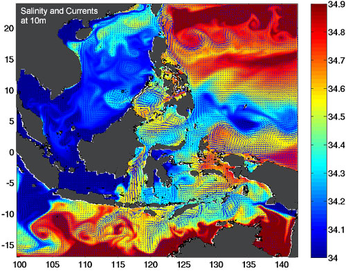
Ocean circulation models are three-dimensional representations of the ocean which are used for studying ocean circulation, climate change, organism distribution and dispersal, marine chemistry, and the distribution and transport of substances in the ocean, including sediments and marine pollutants. These models include factors such as surface air temperature, water temperature and salinity, wind forcing, ocean eddies, and realistic coastline and seafloor features in their calculations. Numerical models can include real-time oceanographic data from ships and satellites to produce forecasts of oceanic conditions, including the El Niño in the Pacific, and the position of the Gulf Stream in the Atlantic.
Author: blueseas
Hydrology

Hydrology is the study of the movement, distribution, and quality of water on Earth. It encompasses both the hydrologic cycle and water resources. The discipline of hydrology includes the fields of hydrometeorology, surface hydrology, hydrogeology, drainage basin management, and water quality.
Fisheries Science

Fisheries Science
Fisheries management draws on fisheries science in order to find ways to protect fishery resources so that sustainable exploitation is possible. Fisheries science is the academic discipline of managing and understanding fisheries. It is a multidisciplinary science, which draws on the disciplines of oceanography, marine biology, marine conservation, ecology, population dynamics, economics and management in an attempt to provide an integrated picture of fisheries.
Plankton Analysis

For many years, Ocean Ecology performed marine plankton identification and enumeration (both phytoplankton and zooplankton) in its laboratory. Samples were collected using either a water bottle or a plankton net. After preservation, the samples were examinined using a microscope. Depending on the particular study being performed, analysis ranged from simply identifying and enumerating harmful algal species to a full analysis of all species present.
Conservation Planning
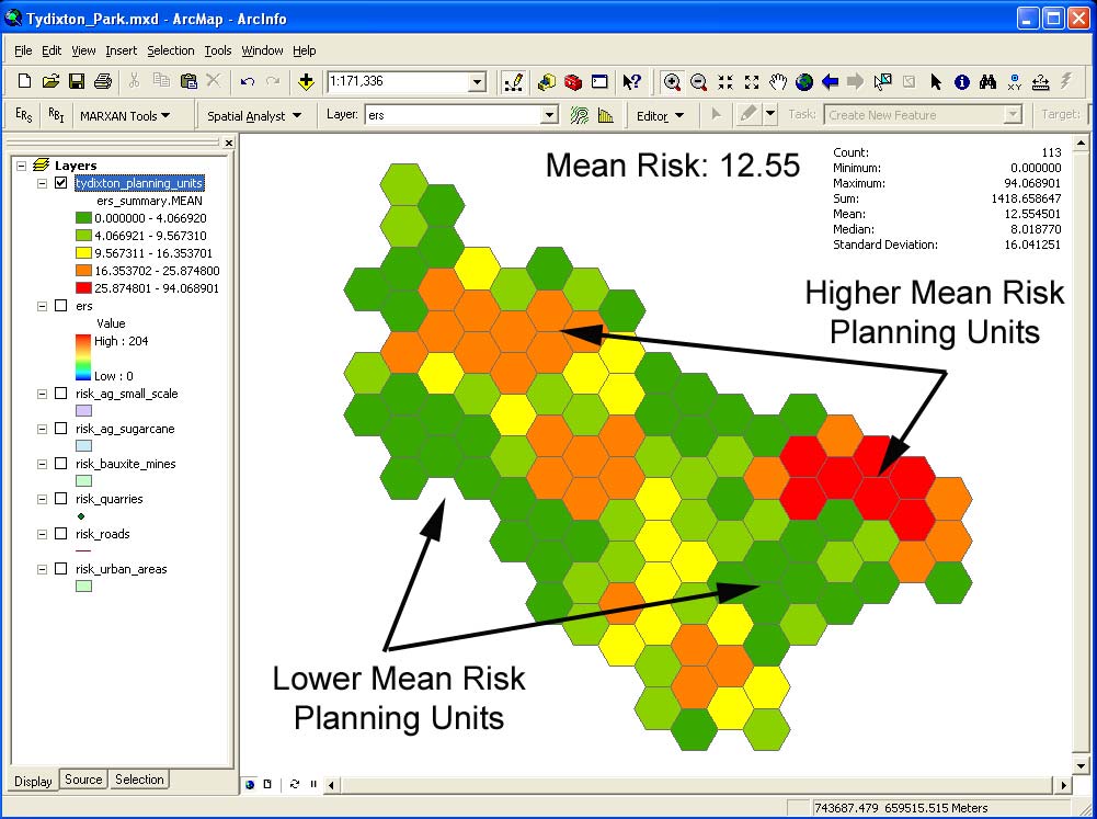
Conservation planning attempts to identify the best course of action to provide long-term protection for conservation targets identified at specific sites. It builds on an ecological summary of the site by adding the identification of conservation targets, threats (stresses and sources of stress), and recommended protection strategies and actions.
Habitat Mapping

Once a map showing the depth, or bathymetry, of a survey site has been generated, it is possible to classify the seafloor into zones based on variations in the bathymetry. These zones have distinct environmental conditions, and form the basis of ecosystem mapping (see above).
Species Modelling

Species modelling (also known as niche modelling) plays an important role in the prediction of species distributions. It provides a way to study biodiversity distribution, past and present, to understand its causes, and to propose scenarios and strategies for sustainable use and for preservation initiatives.
Asking Why

Why is the hardest question you will ever ask. It will change your perspective, and ultimately, if you choose to seek the answer, it will change your life.
Seafloor Mapping

Ocean Ecology designed a towfish system to carry out seafloor mapping which used a single-beam sounder transducer mounted in a highly streamlined towfish that was towed at 1.5 m depth from an A-frame at the stern of our ship. This technique reduced the effects of pitch and roll on the transducer output, which can create significant artifacts in hull-mounted systems.
Geographic Information Systems

Geographical information systems (GIS) consist of computer-based methods of recording, analyzing, combining, and displaying geographic information such as shorelines, bathymetry, habitat types, sensitive areas, or any other feature that can be mapped. GIS are especially useful in management planning and resource-use decisions.